Category:Royal Borough of Kensington and Chelsea
Jump to navigation
Jump to search
Boroughs of London: City of London · City of Westminster · Barking and Dagenham · Barnet · Bexley · Brent · Bromley · Camden · Croydon · Ealing · Enfield · Greenwich · Hackney · Hammersmith and Fulham · Haringey · Harrow · Havering · Hillingdon · Hounslow · Islington · Kensington and Chelsea · Kingston · Lambeth · Lewisham · Merton · Newham · Redbridge · Richmond · Southwark · Sutton · Tower Hamlets · Waltham Forest · Wandsworth
royal borough in the London Region in England    | |||||
| Upload media | |||||
| Instance of | |||||
|---|---|---|---|---|---|
| Location | Greater London, London, England | ||||
| Capital | |||||
| Legislative body |
| ||||
| Executive body |
| ||||
| Head of government |
| ||||
| Inception |
| ||||
| Population |
| ||||
| Area |
| ||||
| Replaces | |||||
| official website | |||||
 | |||||
Subcategories
This category has the following 21 subcategories, out of 21 total.
A
E
F
G
H
M
P
S
T
Media in category "Royal Borough of Kensington and Chelsea"
The following 200 files are in this category, out of 1,874 total.
(previous page) (next page)-

-
-

-
 "Paws", Paddington Bear, Duke of York Square - geograph.org.uk - 4268807.jpg 683 × 1,024; 166 KB
-
 "Paws", Paddington Bear, Duke of York Square - geograph.org.uk - 4268809.jpg 1,024 × 683; 169 KB
-
 "Stripes", Paddington Bear, Cadogan Place - geograph.org.uk - 4282471.jpg 683 × 1,024; 191 KB
-
 "Stripes", Paddington Bear, Cadogan Place - geograph.org.uk - 4282472.jpg 1,024 × 768; 186 KB
-
 "Stripes", Paddington Bear, Cadogan Place - geograph.org.uk - 4282474.jpg 1,024 × 768; 275 KB
-
 "Tardis" Police telephone box - geograph.org.uk - 2388902.jpg 2,736 × 3,648; 2.04 MB
-
 "Tent in the park" pavilion by Design Museum - geograph.org.uk - 5266150.jpg 3,648 × 2,736; 3.49 MB
-

-
 1 Collinham Gardens - geograph.org.uk - 4103631.jpg 480 × 640; 97 KB
-
 113 Cadogan Gardens SW1 - geograph.org.uk - 2105416.jpg 480 × 640; 68 KB
-
 125, Old Church Street Sw3.jpg 4,032 × 3,024; 5.25 MB
-
 13 and 13A - geograph.org.uk - 2798351.jpg 1,024 × 682; 254 KB
-
 15-21 Lowndes Street - geograph.org.uk - 4722329.jpg 640 × 570; 195 KB
-
.jpg/120px-Image_taken_from_page_36_of_%27Old_and_New_London%2C_etc%27_(11191197814).jpg) Image taken from page 36 of 'Old and New London, etc' (11191197814).jpg 1,892 × 1,600; 1.19 MB
Image taken from page 36 of 'Old and New London, etc' (11191197814).jpg 1,892 × 1,600; 1.19 MB
-
_04.jpg/120px-2012-_Sumner_Place%2C_London_SW7_(_Ank_Kumar_)_04.jpg) 2012- Sumner Place, London SW7 ( Ank Kumar ) 04.jpg 2,855 × 1,901; 1.19 MB
2012- Sumner Place, London SW7 ( Ank Kumar ) 04.jpg 2,855 × 1,901; 1.19 MB
-
 23-29 Chesham Street - geograph.org.uk - 4739539.jpg 529 × 640; 166 KB
-
 27-31 Lowndes Street - geograph.org.uk - 4722301.jpg 640 × 531; 179 KB
-
 328 Bus on Finborough Road, Earl's Court - geograph.org.uk - 2221400.jpg 4,000 × 3,000; 5.96 MB
-
 36 Oxford Gardens, W10 - geograph.org.uk - 2860392.jpg 476 × 640; 118 KB
-
 3D digital printing of furniture, Design Museum - geograph.org.uk - 5266313.jpg 1,824 × 1,368; 561 KB
-
_Harrow_Road%2C_W10_-_geograph.org.uk_-_4742080.jpg/120px-431_-_487_(odds)_Harrow_Road%2C_W10_-_geograph.org.uk_-_4742080.jpg) 431 - 487 (odds) Harrow Road, W10 - geograph.org.uk - 4742080.jpg 640 × 480; 104 KB
431 - 487 (odds) Harrow Road, W10 - geograph.org.uk - 4742080.jpg 640 × 480; 104 KB
-
 56-58 Queen's Gate Terrace, SW7 - geograph.org.uk - 5752188.jpg 640 × 640; 167 KB
-
 62 Finborough Road, London - geograph.org.uk - 2224823.jpg 4,000 × 3,000; 3.1 MB
-
 A Christmas Selfie - geograph.org.uk - 4763350.jpg 2,602 × 2,329; 1.58 MB
-
 A Colourful Bridge - geograph.org.uk - 3925308.jpg 1,600 × 1,200; 445 KB
-
 A Crowded Cemetery - geograph.org.uk - 4680571.jpg 4,000 × 2,664; 3.52 MB
-
 A detached house in Cheyne Gardens - geograph.org.uk - 1808624.jpg 480 × 640; 259 KB
-
 A field of poppies comes to Chelsea - geograph.org.uk - 4973724.jpg 640 × 427; 94 KB
-
 A Modern Apothecary - geograph.org.uk - 4969683.jpg 4,000 × 3,000; 4.4 MB
-
 A New Yard To Sit In - geograph.org.uk - 4593376.jpg 3,644 × 2,560; 1.22 MB
-
 A reflection on Chelsea - geograph.org.uk - 5009765.jpg 640 × 427; 112 KB
-
 A snap of Camera Place - geograph.org.uk - 4103954.jpg 640 × 480; 82 KB
-
 A Snowy Westfield Park, Chelsea - geograph.org.uk - 2202830.jpg 4,000 × 3,000; 4.03 MB
-

-

-
 A Wet Day in Chelsea - geograph.org.uk - 3408584.jpg 3,888 × 2,592; 2.6 MB
-
 A3220, West Cross Route - geograph.org.uk - 4143783.jpg 640 × 430; 67 KB
-
 A4207 Bridge - geograph.org.uk - 3822223.jpg 640 × 430; 75 KB
-
 Above the District Line - geograph.org.uk - 3638299.jpg 427 × 640; 121 KB
-
 Access road by the Earls Court Exhibition Centre - geograph.org.uk - 2334979.jpg 1,000 × 1,500; 127 KB
-
 Addison Avenue, W11 - geograph.org.uk - 4359683.jpg 1,600 × 899; 258 KB
-
 Admiral Mews - geograph.org.uk - 3774424.jpg 4,288 × 3,216; 5.23 MB
-
 Airlie Gardens, W8 - geograph.org.uk - 2067515.jpg 480 × 640; 131 KB
-
 Alba Place, off Portobello Road - geograph.org.uk - 2170889.jpg 3,456 × 2,592; 3.22 MB
-
 Alder on the Paddington Branch - geograph.org.uk - 3932343.jpg 2,000 × 1,568; 740 KB
-
-
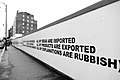 All my explanations are rubbish - geograph.org.uk - 4754734.jpg 1,600 × 1,066; 204 KB
-

-
 All Saints Church, Notting Hill - geograph.org.uk - 4264783.jpg 1,024 × 768; 166 KB
-
 Allen House, Allen St, Kensington - geograph.org.uk - 2059061.jpg 2,472 × 3,296; 2.27 MB
-
 Alleyway to Ladbroke Grove - geograph.org.uk - 3774451.jpg 4,288 × 3,216; 4.89 MB
-
 Anderson St - geograph.org.uk - 4181489.jpg 640 × 430; 80 KB
-
 Angelo raguso selfie.jpg 2,320 × 3,088; 1.59 MB
-
 Apartment block on Fulham Road - geograph.org.uk - 4219977.jpg 640 × 410; 121 KB
-
 Apartment block, Kensal Town - geograph.org.uk - 3972985.jpg 640 × 430; 76 KB
-
 Apartment block, Portobello Rd - geograph.org.uk - 5530753.jpg 426 × 640; 73 KB
-
 Apartments facing Ranelegh Gardens - geograph.org.uk - 5736715.jpg 640 × 471; 91 KB
-
 Apartments, Kensal Town - geograph.org.uk - 5201460.jpg 640 × 426; 72 KB
-
_-_geograph.org.uk_-_4849305.jpg/120px-Approaching_canal_bridge_4c_(Great_Western_Road)_-_geograph.org.uk_-_4849305.jpg) Approaching canal bridge 4c (Great Western Road) - geograph.org.uk - 4849305.jpg 1,600 × 1,200; 323 KB
Approaching canal bridge 4c (Great Western Road) - geograph.org.uk - 4849305.jpg 1,600 × 1,200; 323 KB
-
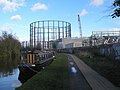 Approaching the gasworks near Kensal Green - geograph.org.uk - 4849290.jpg 1,600 × 1,200; 357 KB
-

-

-
-

-
-

-

-
-
-
-

-

-
-
-
-

-

-
-

-
 Archaeologist's Tombstone - geograph.org.uk - 4679900.jpg 3,872 × 2,412; 3.47 MB
-
 Arriving at the Carnival - geograph.org.uk - 3621519.jpg 640 × 498; 108 KB
-
 Artwork under Carlton Bridge - geograph.org.uk - 2421721.jpg 800 × 600; 429 KB
-
 Arundel Gardens - geograph.org.uk - 4366678.jpg 1,024 × 680; 130 KB
-
 Ashburn Gardens - geograph.org.uk - 4167644.jpg 640 × 430; 92 KB
-
 Ashburn Gardens - geograph.org.uk - 5203342.jpg 1,600 × 1,082; 592 KB
-
 Ashburn Gardens, Kensington - geograph.org.uk - 5762744.jpg 3,200 × 1,935; 3.65 MB
-
 Ashburn Gardens, Kensington - geograph.org.uk - 5762751.jpg 2,560 × 1,708; 3.41 MB
-
 Astley House, Kensington Church St - geograph.org.uk - 4008844.jpg 640 × 430; 66 KB
-
 At Queen's Gate - geograph.org.uk - 5416380.jpg 4,072 × 2,810; 4.55 MB
-
 Aubrey Walk - geograph.org.uk - 5530336.jpg 640 × 426; 67 KB
-
 Autumn colours in Fawcett Street, Chelsea - geograph.org.uk - 2143581.jpg 3,000 × 4,000; 3.89 MB
-
 Autumn down Elsham Road - geograph.org.uk - 4210821.jpg 1,600 × 1,067; 473 KB
-
 Avondale Park - geograph.org.uk - 4993885.jpg 640 × 480; 185 KB
-
 Avondale Park Gardens - geograph.org.uk - 4993871.jpg 1,800 × 640; 386 KB
-
 Babylon Restaurant Terrace - geograph.org.uk - 5244768.jpg 5,918 × 3,945; 3.38 MB
-
 Babylon Roof Gardens Restaurant - geograph.org.uk - 5244775.jpg 5,800 × 3,866; 2.53 MB
-
 Backing onto the Grand Union Canal - geograph.org.uk - 3815756.jpg 640 × 430; 70 KB
-
 Backing onto the Grand Union Canal - geograph.org.uk - 3815762.jpg 640 × 430; 76 KB
-
 Balancing the stone - geograph.org.uk - 4974578.jpg 427 × 640; 104 KB
-
 Balcony on Madam Sophie's, viewed from Portobello Road - geograph.org.uk - 2170985.jpg 3,456 × 2,592; 3.06 MB
-
 Balfour House and Carmelite Monastery - geograph.org.uk - 2432181.jpg 1,024 × 683; 174 KB
-
 Bank in woodland to conserve rainwater, Holland Park - geograph.org.uk - 5807948.jpg 2,736 × 2,049; 3.26 MB
-
 Bank Melli Iran, Kensington - geograph.org.uk - 2654054.jpg 640 × 484; 71 KB
-
 Bank Melli Iran, Kensington - geograph.org.uk - 2863227.jpg 4,000 × 3,000; 3.28 MB
-
 Baptist Church, Kensington Place - geograph.org.uk - 5530380.jpg 640 × 426; 61 KB
-
 Barclay Bike Docking Station on Freston Road - geograph.org.uk - 3772954.jpg 4,288 × 3,216; 5.52 MB
-

-

-

-
 Barge in Chelsea Reach - geograph.org.uk - 5375486.jpg 640 × 357; 72 KB
-
 Barkston Gardens - geograph.org.uk - 4167515.jpg 640 × 430; 89 KB
-
 Barkston Gardens - geograph.org.uk - 4167531.jpg 640 × 430; 132 KB
-
 Barkston Gardens - geograph.org.uk - 4167536.jpg 640 × 410; 117 KB
-
 Barkston Gardens - geograph.org.uk - 4167545.jpg 640 × 430; 140 KB
-
 Barkston Gardens - geograph.org.uk - 4167557.jpg 640 × 430; 93 KB
-
 Barkston Gardens - geograph.org.uk - 4167561.jpg 640 × 430; 106 KB
-

-
 Basin by the Grand Union Canal - geograph.org.uk - 3815733.jpg 640 × 430; 58 KB
-
 Basing Street - geograph.org.uk - 3620272.jpg 640 × 480; 89 KB
-
 Bassett House, Bassett Road W10 - geograph.org.uk - 5170228.jpg 480 × 640; 62 KB
-
 Bayswater Road at Caroline House - geograph.org.uk - 5841671.jpg 640 × 480; 108 KB
-
 BBC film crew at work - geograph.org.uk - 4988057.jpg 640 × 427; 103 KB
-
.jpg/120px-Bears_Den%2C_Tabernacle%2C_London_(32508141377).jpg) Bears Den, Tabernacle, London (32508141377).jpg 3,072 × 1,728; 1,017 KB
Bears Den, Tabernacle, London (32508141377).jpg 3,072 × 1,728; 1,017 KB
-
 Beauchamp Place, Knightsbridge - geograph.org.uk - 4338002.jpg 2,272 × 1,704; 719 KB
-
 Beaufort Gardens - geograph.org.uk - 2492321.jpg 427 × 640; 89 KB
-
 Bench at entrance to Collingham Gardens London - geograph.org.uk - 2184527.jpg 4,000 × 3,000; 4.62 MB
-
 Berens Road and The Georgian House - geograph.org.uk - 2421806.jpg 800 × 600; 491 KB
-
 Best Western Burns Hotel - geograph.org.uk - 4167542.jpg 430 × 640; 78 KB
-
 Best Western Hotel, Barkston Gardens - geograph.org.uk - 4167520.jpg 640 × 430; 85 KB
-
 Bike Station, Holland Park, Kensington - geograph.org.uk - 2737241.jpg 4,288 × 3,216; 6.82 MB
-
 Bina Gardens, London - geograph.org.uk - 1853910.jpg 2,813 × 2,998; 2.63 MB
-
 Black Cab - geograph.org.uk - 4937489.jpg 3,959 × 2,639; 7.17 MB
-
 Bladon Lodge, Chelsea - geograph.org.uk - 2736163.jpg 4,288 × 3,216; 5.21 MB
-
 Block of flats in Runcorn Place, London - geograph.org.uk - 2667371.jpg 4,000 × 3,000; 3.91 MB
-
 Bluebell - narrowboat on Paddington Arm, Grand Union Canal - geograph.org.uk - 4461317.jpg 3,648 × 2,736; 3.94 MB
-
 Boathouse Centre - geograph.org.uk - 2861658.jpg 480 × 640; 68 KB
-
 Boats moored - geograph.org.uk - 5289983.jpg 640 × 426; 73 KB
-
 Boats parked by Battersea Bridge - geograph.org.uk - 2099520.jpg 640 × 430; 119 KB
-
 Bolebec House, Lowndes Street - geograph.org.uk - 4722328.jpg 640 × 496; 173 KB
-
 Bollards in Swan Walk - geograph.org.uk - 4108257.jpg 640 × 480; 97 KB
-
 Bolton Gardens Kensington - geograph.org.uk - 3430806.jpg 2,448 × 3,264; 3.54 MB
-
 Bolton Gardens, Earl's Court - geograph.org.uk - 2863222.jpg 4,000 × 3,000; 3.07 MB
-
 Bonchurch Road, Ladbroke Grove - geograph.org.uk - 5188760.jpg 3,264 × 2,448; 2.05 MB
-
 Bottom end of Bury Walk - geograph.org.uk - 4109923.jpg 474 × 640; 72 KB
-

-

-
 Bourne St - geograph.org.uk - 4194420.jpg 640 × 430; 79 KB
-
 Bourne Street, Belgravia - geograph.org.uk - 4337243.jpg 2,272 × 1,704; 801 KB
-
 Bowden Court hostel, ^24 Ladbroke Road - geograph.org.uk - 2846241.jpg 1,024 × 683; 233 KB
-
 Bowling Green House, Riley Street Chelsea - geograph.org.uk - 2139909.jpg 4,000 × 3,000; 4.54 MB
-
 Bramley Arms - geograph.org.uk - 3772958.jpg 4,288 × 3,216; 6.77 MB
-
 Bray Place - geograph.org.uk - 4181493.jpg 640 × 430; 72 KB
-
 Brazilian jiu jitsu, Kensal Road - geograph.org.uk - 2735677.jpg 3,452 × 2,590; 1 MB
-
 Breakfast at The Ivy - geograph.org.uk - 5407445.jpg 4,547 × 3,006; 2.74 MB
-
 Bridge 4 Paddington Arm - Ladbroke Grove west access - geograph.org.uk - 2735520.jpg 3,648 × 2,736; 2.88 MB
-

-

-

-
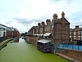
 Bridge and buildings, Grand Union Canal - geograph.org.uk - 2267068.jpg 640 × 480; 107 KB
-

-
 Britteal Street - geograph.org.uk - 3637213.jpg 427 × 640; 122 KB
-
 Broad walk in Holland Park - geograph.org.uk - 4880369.jpg 3,648 × 2,736; 4.85 MB
-
 Brompton Medical Centre - geograph.org.uk - 2240611.jpg 4,000 × 3,000; 2.9 MB
-
 Brompton Medical Centre - geograph.org.uk - 5761308.jpg 1,024 × 768; 197 KB
-
-
 Brompton Road tube station - geograph.org.uk - 5787163.jpg 4,000 × 3,000; 2.31 MB
-

-
 Builder's yard, West Kilburn - geograph.org.uk - 2421788.jpg 800 × 600; 434 KB
-
 Building by the Grand Union Canal - geograph.org.uk - 3815742.jpg 640 × 430; 67 KB
-
 Building site on Sloane Street - geograph.org.uk - 3992740.jpg 640 × 480; 136 KB
-
 Buildings by the Grand Union Canal - geograph.org.uk - 2860565.jpg 640 × 480; 77 KB
-
 Buildings by the Harrow Road - geograph.org.uk - 2861230.jpg 493 × 640; 60 KB
-
 Buildings in Christchurch Street - geograph.org.uk - 4108357.jpg 480 × 640; 75 KB
-
 Buildings in Pond Place - geograph.org.uk - 4109931.jpg 640 × 480; 97 KB
-

-
 Bullingham Mansions - geograph.org.uk - 5234671.jpg 3,000 × 4,000; 3.78 MB
-
 Burleigh House, St Charles Square, North Kensington - geograph.org.uk - 1812265.jpg 4,000 × 3,000; 4.08 MB
-
 Burton's Court - geograph.org.uk - 4977275.jpg 1,540 × 1,150; 513 KB
-
 Bury Walk - geograph.org.uk - 4368037.jpg 4,912 × 3,264; 4.69 MB
-
 Bus Stop N, Finborough Road, Earls Court - geograph.org.uk - 3615375.jpg 2,448 × 3,264; 2.37 MB
-
-
 Bus stops, Shepherd's Bush - geograph.org.uk - 1816572.jpg 1,000 × 649; 131 KB
-
 Cadogan Gardens, Chelsea - geograph.org.uk - 5813090.jpg 2,048 × 1,536; 1.52 MB
-
 Cadogan Pier - geograph.org.uk - 5295645.jpg 640 × 426; 54 KB
-
 Cadogan Pier and Albert Bridge - geograph.org.uk - 5295674.jpg 640 × 426; 82 KB
-
 Cadogan Pier, Chelsea - geograph.org.uk - 3616912.jpg 3,264 × 2,448; 2.44 MB
-
 Café - Boulangerie in Chelsea - geograph.org.uk - 4528740.jpg 6,000 × 4,000; 5.68 MB
-
 Café Rouge, Basil Street - geograph.org.uk - 4286883.jpg 800 × 600; 128 KB
-
 Cambridge Road - geograph.org.uk - 3269047.jpg 2,736 × 3,648; 2.01 MB
-
 Cameroon High Commission - geograph.org.uk - 4143882.jpg 640 × 430; 88 KB
-
 Campden Hill Court, Kensington - geograph.org.uk - 4232572.jpg 1,200 × 1,600; 559 KB
-
 Campden Hill Gardens - geograph.org.uk - 5530334.jpg 640 × 425; 66 KB
-
 Campden Hill Square, Holland Park - geograph.org.uk - 4384695.jpg 2,304 × 1,728; 830 KB
-
 Campden Houses No.1 - geograph.org.uk - 5530341.jpg 425 × 640; 89 KB
-
 Campden Houses No.2 - geograph.org.uk - 5530345.jpg 425 × 640; 87 KB
-
 Campden Houses No.3 - geograph.org.uk - 5530342.jpg 426 × 640; 83 KB
-
 Campden Houses No.4 - geograph.org.uk - 5530346.jpg 426 × 640; 89 KB


.jpg)
_04.jpg)


_Harrow_Road,_W10_-_geograph.org.uk_-_4742080.jpg)


_-_geograph.org.uk_-_4849305.jpg)


.jpg)


